Introduction
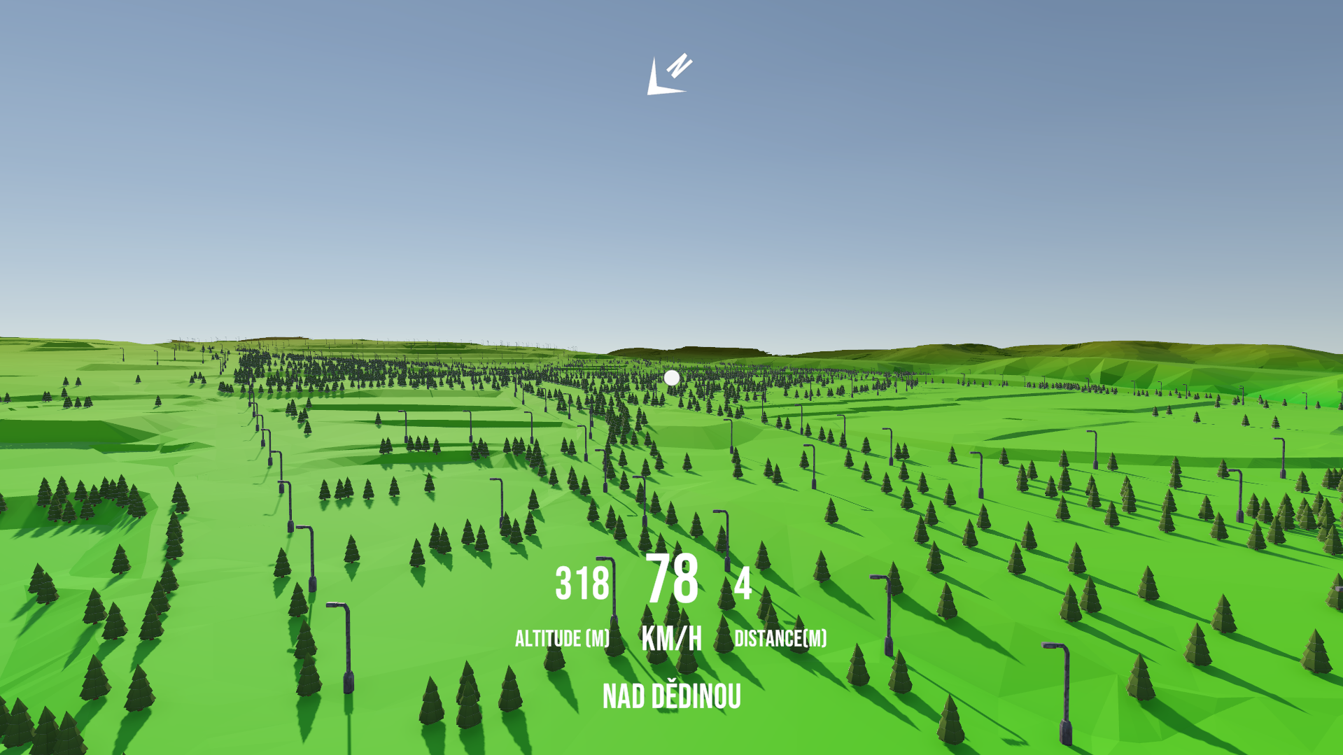
During my time at HCILab, under the supervision of Jonas Rosecký, I developed GISMU, a Unity-based system for visualizing geospatial data in 3D. The project focused on Brno, CZ, exploring how terrain, transport, and infrastructure data could be transformed into an interactive environment — with future potential for VR exploration.
What We Built
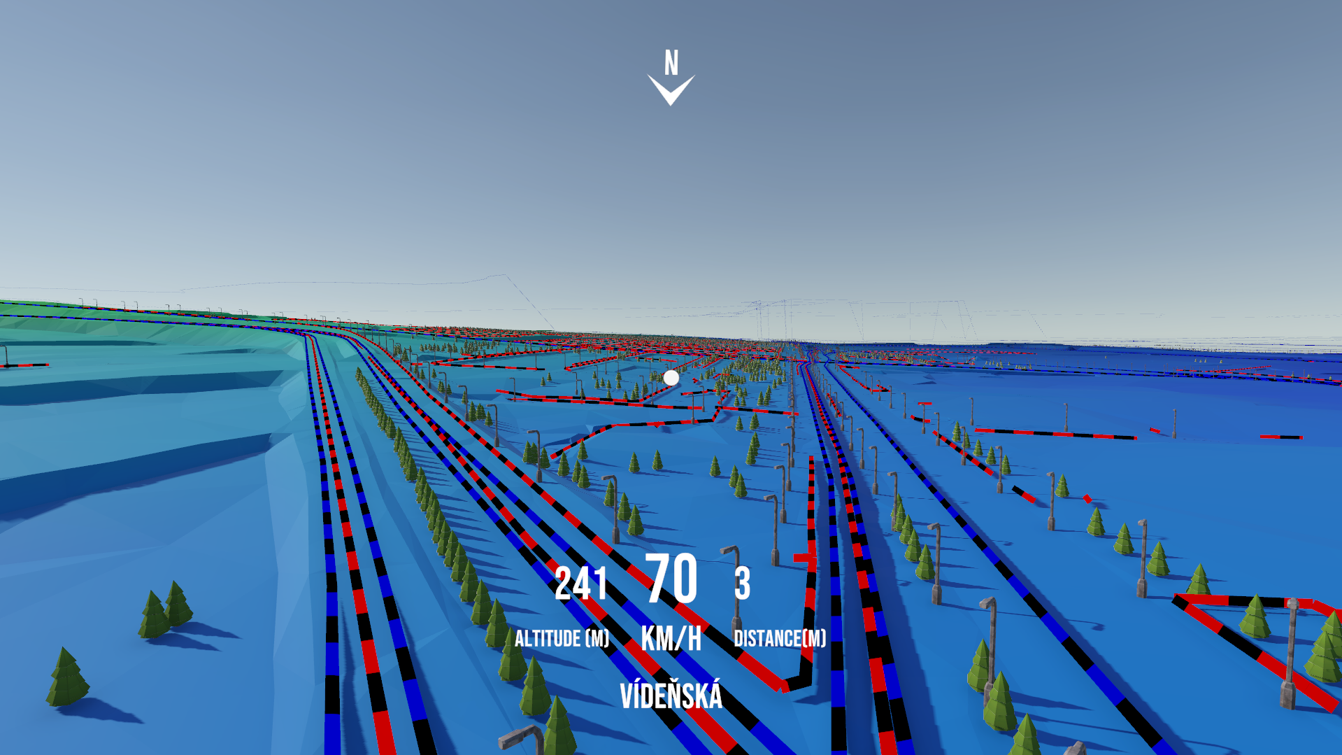
GISMU reconstructs Brno’s terrain from the 2019 Digital Terrain Model and layers it with multiple datasets from data.brno.cz , including:
- Public transport lines (bus routes)
- Sidewalk networks
- Trees
- Streetlights
The tool parses shapefiles directly (Polygon, LineString, and Point geometries) using NetTopologySuite, enabling a modular pipeline for extending to new datasets.
Challenges & Design Decisions
Working with millions of spatial objects in Unity was a significant challenge. To make the system performant, I implemented several optimizations:
1. Efficient Rendering with Mesh Instancing
Rendering thousands of trees, lights, and other points individually quickly overwhelmed Unity. To solve this, I used GPU mesh instancing, batching objects into groups of 1000. This reduced draw calls drastically and kept framerates stable.
2. Raycasting for Terrain Alignment
All objects from sidewalk lines, tree points, and streetlight points had to “sit” on top of the terrain mesh. Instead of guessing heights from raw data, I used raycasting against the reconstructed terrain so each object was properly aligned, even with elevation changes.
The raycasting is done during runtime sequentially in batched to reduce performance overhead during setup calculation.
3. Shapefile Parsing with NetTopologySuite
Using NetTopologySuite with Esri shapefile support, I was able to directly read geospatial geometries and convert them into Unity meshes. This required building a robust coordinate transformation system (SJTSK → WGS84 → Unity world coordinates) with ProjNet.
4. Terrain Chunking for Performance
The terrain of Brno covers a large area. To avoid hitting Unity’s 65k vertex per mesh limit and to improve culling, I split the terrain into uniform centroid grid chunks. Each chunk could then be managed independently, improving both memory use and runtime efficiency.
Why It Matters
GISMU shows how game engines like Unity can be applied beyond games, giving geospatial data an interactive and immersive dimension. With potential VR integration, GISMU opens possibilities for:
- Urban planning & infrastructure visualization
- Educational tools for geography and city studies
- General-purpose geospatial exploration
Conclusion
This project combined computer graphics techniques, GIS processing, and Unity optimizations into a cohesive pipeline. The end result: a tool that turns raw shapefiles into an explorable 3D city landscape — bridging geospatial science and immersive visualization.
You can find the presentation and project below.


